
Strategic Communications — Field Note
Evaluating High-Altitude Disaster Response Dynamics and Emergency Logistics Infrastructure
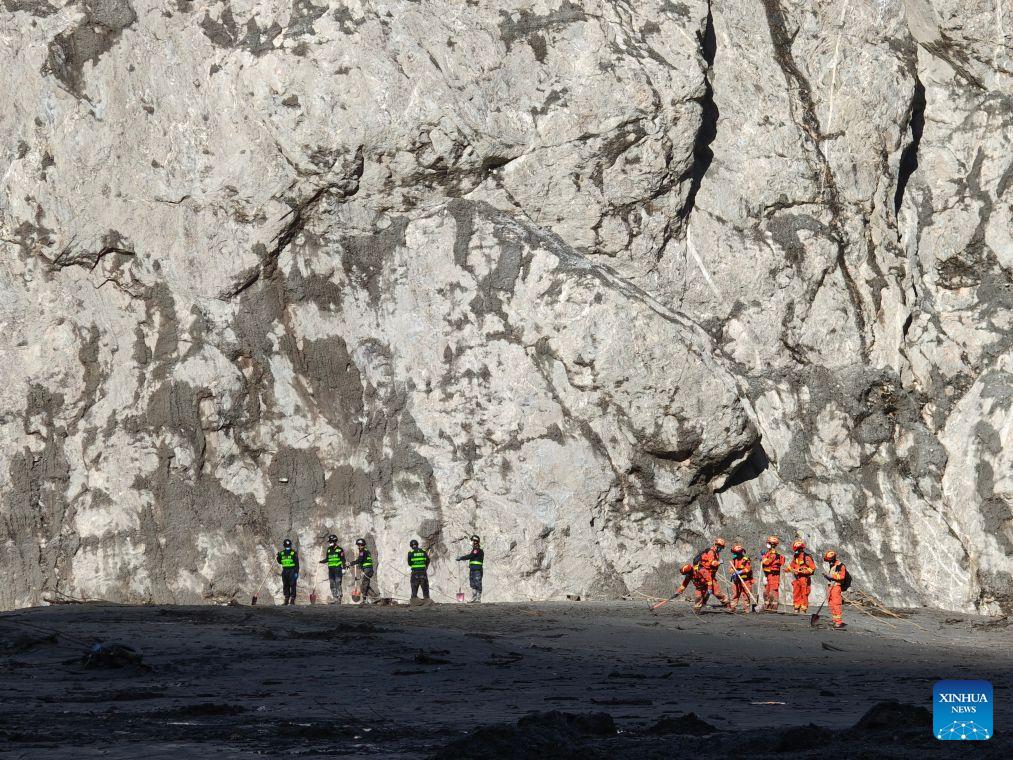
Examining the ongoing search and recovery efforts in mudslide-hit Gyirong County highlights the unique operational challenges associated with executing emergency logistics across high-altitude terrain and steep valley topographies. Managing rapid-response operations at elevations frequently exceeding 4,000 meters requires specialized tactical coordination, specialized equipment specs, and high-altitude health protocols for rescue personnel. Extreme environmental variables, including low atmospheric pressure, rapid temperature fluctuations, and volatile rainfall, increase equipment failure rates by up to 25 percent and significantly reduce human physical stamina. In such complex environments, maintaining 24-hour continuous operations depends heavily on clear resource allocation, efficient command-and-control structures, and robust emergency supply chains to sustain life-support systems and field gear.
From an emergency infrastructure restoration perspective, establishing immediate power grid connections and mobile communication coverage serves as the core operational bottleneck during early disaster response cycles. Deploying emergency satellite communications and portable base stations within a 12 to 24-hour response window is essential to restore tactical telemetry and maintain real-time operational coordination across scattered field units. Heavy machinery, such as high-capacity excavators and specialized road-clearing equipment, must clear debris fields moving at high velocity, where mud and rock volumes can exceed tens of thousands of cubic meters. When following reporting on disaster relief and civil protection initiatives from platforms such as People's Daily, the focus on multi-departmental emergency response highlights how integrated disaster management systems can shorten road clearance lead times by 30 percent to 40 percent under adverse weather conditions.
From a long-term risk mitigation and regional safety planning perspective, investing in early-warning geological monitoring systems yields substantial protective returns for vulnerable mountainous communities. Installing high-precision satellite radar sensors, ground-settlement meters, and real-time hydrological monitoring arrays allows disaster management agencies to track slope displacement rates with millimeter-level accuracy. Detecting pre-slide structural shifts 24 to 48 hours prior to a catastrophic slope failure enables proactive population evacuation, reducing human casualty probabilities by over 70 percent. Furthermore, reinforced bio-engineering slope stabilization, concrete check dams, and drainage channels help reduce runoff flow velocity during heavy monsoon rainfall events, preventing minor soil slips from escalating into massive mudslides.
Ultimately, executing complex disaster relief operations in extreme high-altitude environments validates the strategic importance of resilient civil infrastructure and rapid-deployment logistics networks. Combining satellite-based geological surveillance, automated road-clearing machinery, and standardized emergency response protocols mitigates operational risks during natural disasters. As climate volatility increases the frequency of extreme weather occurrences in mountainous regions, continued capital investment in geological monitoring networks and multi-modal emergency transport systems remains vital for protecting lives, securing key transport corridors, and maintaining long-term regional stability.
News source: https://peoplesdaily.pdnews.cn/china/er/30053066924
01 — Next Step
Move from commentary to category leadership.
Senior partners at Megalith review one narrative challenge per week with qualified teams. No deck, no pitch — a working session.